 |
| Finding waypoints. |
Fortunately, it was not a journey I had to take without guidance. Vanderbilt professors, Janey Camp and Steve Baskauf (also a USN alumni dad), generously provided their time and expertise so our 5th graders could dip their toes in GIS mapping. Janey and Steve's passion in this field was inspiring. Their collaboration was instrumental in helping me design a project that would be engaging, yet developmentally age appropriate for 5th graders. The objective of the project was to develop a core set of skills to get students thinking of maps they could design in the future.
 |
| Recreating primary source image with iPad. |
 |
| Recording changes in the landscape. |
 |
| Analyzing primary source. |
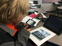
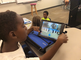
from the USN archives taken on Vanderbilt's Magnolia Lawn from the 1930's to the 1990's. Students, in groups of three to four, spent time in class analyzing the different images using the thinking routine, See, Think, Wonder. Students were told they would take a walk over to Magnolia Lawn to determine the original spot their image was taken and recreate it. Using the iPad, students marked up distinct landmarks on the digital images. It was no surprise that all of the students identified the trees as targeted landmarks.
Our next step was for students to learn how to collect data by locating waypoints (latitude and longitude) using GPS devices and to record their observations on field notes. So, off we went across the street to Magnolia Lawn with GPS devices, iPads and clipboards in hand. At first, following the multiple steps required to use the GPS devices brought on a few challenges. After reading their reflections, what they considered to be a focal point, the trees, in reality became somewhat of an obstacle. Here are some of the student reflections noting the different ways the landscape of Magnolia Lawn & the USN Edgehill entrance have changed over the years:
Maya: "The tree in my picture was much more decayed and broken down. There was more foliage, so it was hard to identify the location of the photographer."
Eva: "So much has changed on Magnolia Lawn. Things like trees, bushes, and things that might have otherwise been keys to finding the spot where the picture was taken are no longer there."
Townsend: "There were bike racks along the grass at USN. There are a lot more trees today than in 1950. The doors of the school are brown today, not white. A lot of the trees in my photo are not there, so it was very hard to find the right place to take the photo."
Lindsey: "I was looking for a crack in the road, but since the road had been fixed, the crack was not there. I was looking for a tree split in half at the bottom with ivy all over it, but the tree was not there. I had a lot of fun doing this project, and I think that you should do it next year. I had fun trying to find the spot and the angle of the picture. Also, it was a little bit of a challenge because a lot of the characteristics that were there in the 1980’s were not there when I recreated the picture. It was like a puzzle, and I had fun finding the pieces."
After collecting the data, students created maps with location pins, before/after photo images, and text explaining some of the changes. When mapping their latitude and longitude points, some groups quickly realized the importance of accurately recording waypoints. A pinpoint on the map in Alabama or Antarctica was a sure sign something was off!
 |
| Using Explain Everything app to mark up primary source. |
Our next step was for students to learn how to collect data by locating waypoints (latitude and longitude) using GPS devices and to record their observations on field notes. So, off we went across the street to Magnolia Lawn with GPS devices, iPads and clipboards in hand. At first, following the multiple steps required to use the GPS devices brought on a few challenges. After reading their reflections, what they considered to be a focal point, the trees, in reality became somewhat of an obstacle. Here are some of the student reflections noting the different ways the landscape of Magnolia Lawn & the USN Edgehill entrance have changed over the years:
Maya: "The tree in my picture was much more decayed and broken down. There was more foliage, so it was hard to identify the location of the photographer."
Eva: "So much has changed on Magnolia Lawn. Things like trees, bushes, and things that might have otherwise been keys to finding the spot where the picture was taken are no longer there."
Townsend: "There were bike racks along the grass at USN. There are a lot more trees today than in 1950. The doors of the school are brown today, not white. A lot of the trees in my photo are not there, so it was very hard to find the right place to take the photo."
Lindsey: "I was looking for a crack in the road, but since the road had been fixed, the crack was not there. I was looking for a tree split in half at the bottom with ivy all over it, but the tree was not there. I had a lot of fun doing this project, and I think that you should do it next year. I had fun trying to find the spot and the angle of the picture. Also, it was a little bit of a challenge because a lot of the characteristics that were there in the 1980’s were not there when I recreated the picture. It was like a puzzle, and I had fun finding the pieces."
Philip: "One of the human characteristics that was in my photo and is not around anymore is the white paint on the front of USN. A physical characteristic that is not around today is the extremely heavy foliage of the trees in one of the photos. We ran into many look alike trees, and other things that were confusing, such as which building to choose, as they all had columns. I think we worked very well together, seeing as we found all three photographs. We had a good time in the process, all cooperating together and checking the others' views of where the photograph might be taken from, and often agreeing with each other."
Myla: "There are no longer ridges on the stone wall as seen in the primary source, now it's now just a flat stone wall. We had a hard time finding the exact waypoint of the 1942 photo because there were trees blocking the building, so we couldn't see where we needed to stand. Finding the 1992 image location was challenging because now there is a tree that is blocking the direct view of the building. We found a tree that was in the primary source, but now it is much bigger."
 |
| Found the flowering dogwood tree, still standing. Used PicCollage app to create before/after shots. |
| Street between Magnolia Lawn and USN made this picture tricky to recreate. |
After collecting the data, students created maps with location pins, before/after photo images, and text explaining some of the changes. When mapping their latitude and longitude points, some groups quickly realized the importance of accurately recording waypoints. A pinpoint on the map in Alabama or Antarctica was a sure sign something was off!
 |
| Final student ArcGis map project. |
Judging from the student reflections, everyone contributed towards the common goal using their unique talents for the good of the entire group and had fun in the process!
