The National Council for Geographic Education (NCGE) holds an annual conference that is hosted in different cities every year. This summer it was held in Memphis which seemed like the perfect opportunity for me to connect and learn along with other educators from around the globe. There were so many interesting sessions offered that I, at times, felt torn wanting to be in three different places at one time!
A major part of the sessions included student learning opportunities that incorporated Geographic Information System (GIS). Advances in technology now allow our students to have access to current data which engages them in analysis, interpretation and critical thinking related to data maps. ArcGIS Online, a cloud based program, is one of those resources. ArcGis along with Google Maps also allows for time travel to explore past landscapes throughout history. The idea is for students to become geo-literate, looking for patterns in real-time like where people live and why.
National Geographic also presented its recently launched resources that offers educators map-based materials designed to build spatial thinking skills. Their mobile friendly technologies allow students to create and share their own map-based, multimedia geotours.
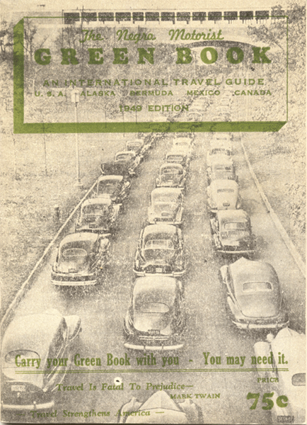
In addition to the GIS concept, sessions included activities using literature to make connections to reading, primary sources and maps. I felt like I was making curricular tweaks with each session I attended! For instance this year in our Civil Rights unit, I plan to incorporate the Green Book (1936-1964) which helped African American automobile travelers identify accommodations during the Jim Crow era. The session showcased teaching strategies using the Green Book, as a primary source, and the picture book Ruth and the Green Book in relation to geographic advancements in studying race relations, mobility and civil rights.
The last day of the conference a quote posted from President Obama caught my eye, "The study of geography is more than just memorizing places on a map, it's about understanding the complexity of our world." It truly sums up how the conference reinforced the importance of geography and that maps tell stories. The possibilities of using 21st century technology just makes the learning experience more authentic and engaging.


No comments:
Post a Comment